Horton and Wraysbury Neighbourhood Plan
Additional Documents
Updated 18th December 2018
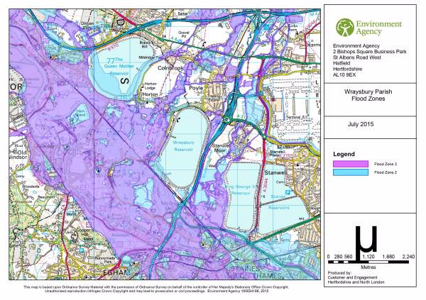
Below is a map of the flood plain acquired from the Environment Agency. Additional maps at a higher resolution are available on the Wraysbury Parish Web Site or by following the links under the picture.
Other maps are available at:-
Horton
Hythe End
Wraysbury East
Wraysbury NorthEast
Wraysbury Parish
Wraysbury SouthWest
Flooding in Feb
2014
Updated 18th December 2018
Map with Areas for Character Assessment
River Thames Scheme - the six alternative plans aired at open day on 10th October
Maps
| Note dated 11 July 2016 (updated 27th October) - the following maps formed the basis for developing the Character Assessments. They are interesting to show the development of ideas, but are not the definitive documents. They will be found in the Character Assessment document where applicable. |
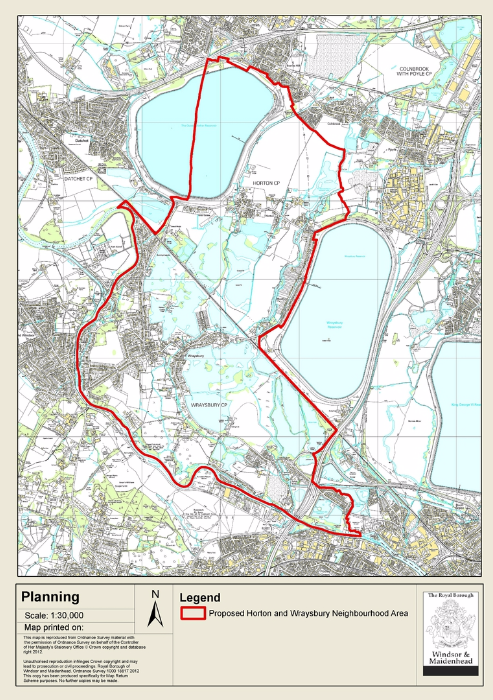
The area covered by
this Neighbourhood Plan
The areas
identified in the character assessment
The individual character assessment areas
Green Belt (Not yet very helpful - working on addition to area maps)